NASA just launched its next-generation sea ice monitoring satellite
ICESat-2 was launched from California over the weekend.
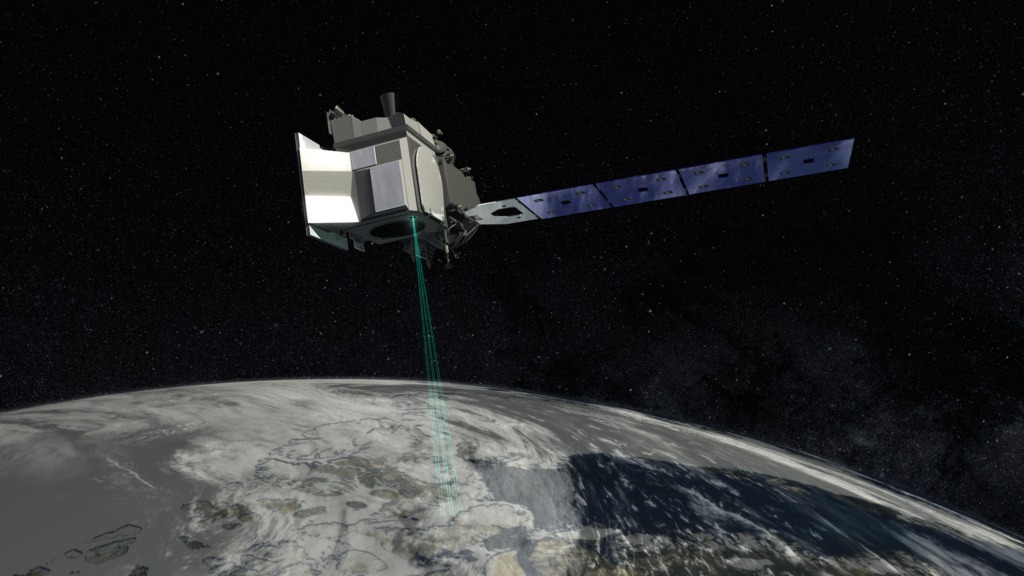
NASA launched its Ice, Cloud and Land Elevation Satellite-2, known as ICESat-2, which will use an extremely precise laser to collect measurement data to track the Earth’s shrinking polar ice, on Saturday from Vandenberg Air Force Base in California.
The laser, known as ATLAS (Advanced Topographic Laser Altimeter System), splits into six beams and fires 10,000 pulses per second to collect very precise measurements for scientists to analyze. The satellite’s orbit will take 91 days before repeating, allowing the device to measure the same locations four times a year, so scientists can see how they change over seasons.
The ATLAS will focus on two areas: changes to the earth’s ice sheet and sea ice thickness change. It will measure sea ice thickness by measuring the heights or elevations of sea ice and comparing the height of the ice with the height of the adjacent open water to find out the measurement of sea ice freeboard, the portion of sea ice floating above the water. Its measurements of the height of ocean and land surfaces will provide a 3-dimensional image of the Earth’s surface.
NASA expects the project will shed light on how much the Arctic and Antarctic ice sheets grow and shrink each year, improving our understanding of sea level rise and how it impacts communities around the world.
Read more: