How artificial intelligence could help get better ice charts to mariners faster
By training computers to identify ice on satellite images, humans will be able make full use of all the data that is available to them
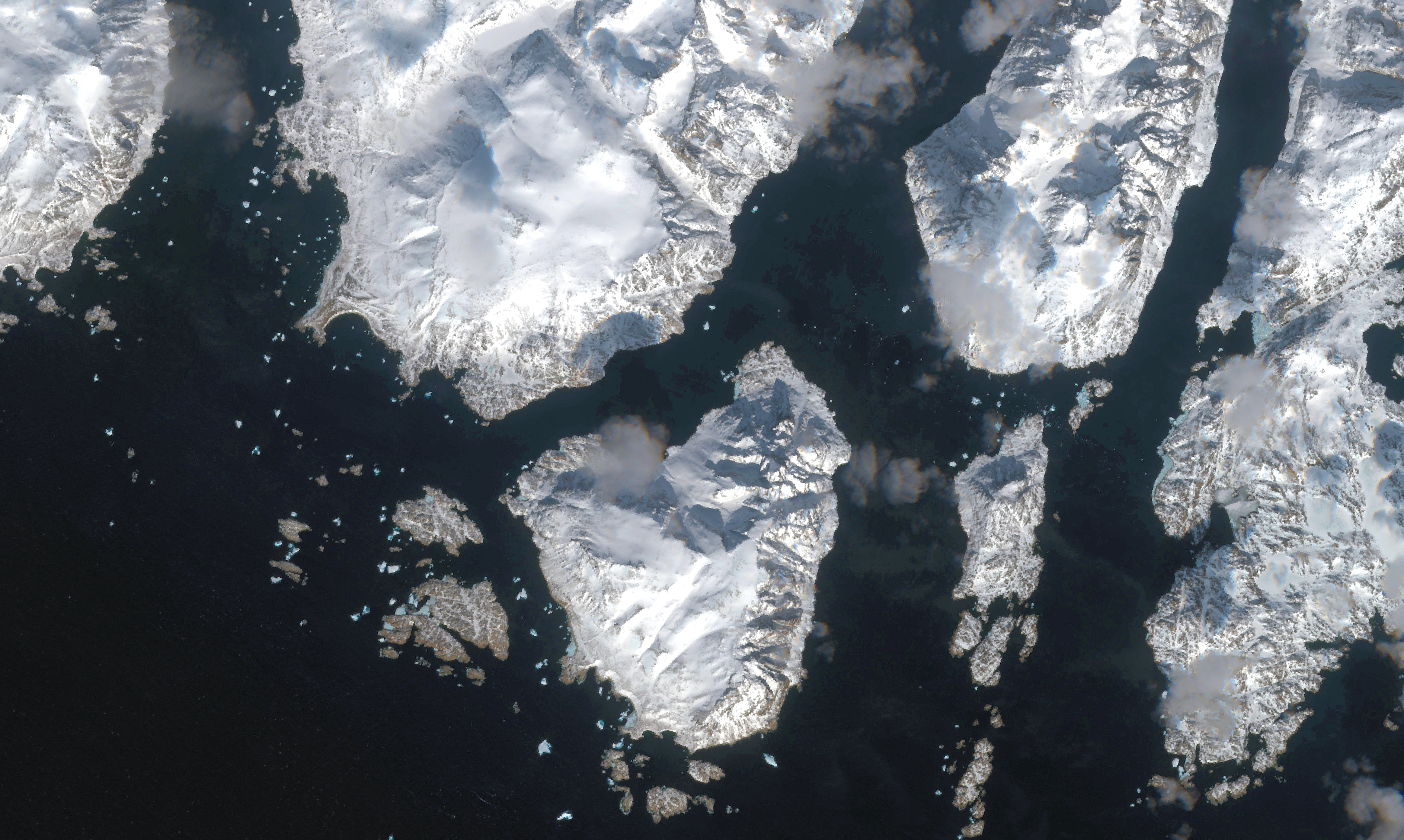
Even though modern ice charts are made, to a large extent, using advanced satellite imagery, the process of actually compiling them still requires a human touch: All those pictures beamed back to Earth must be analyzed by meteorologists, and the charts that mariners will eventually use must be drawn up manually.
The process can be time consuming, and, in the between the time the image was received and the time it winds up in the hands of a mariner, the conditions at sea may have changed, with ice either diminishing or appearing in areas where it wasn’t previously.
So what if computers could be taught to help meteorologists in their task by going over images and to predict and then drawing up a preliminary chart that they could verify and release?
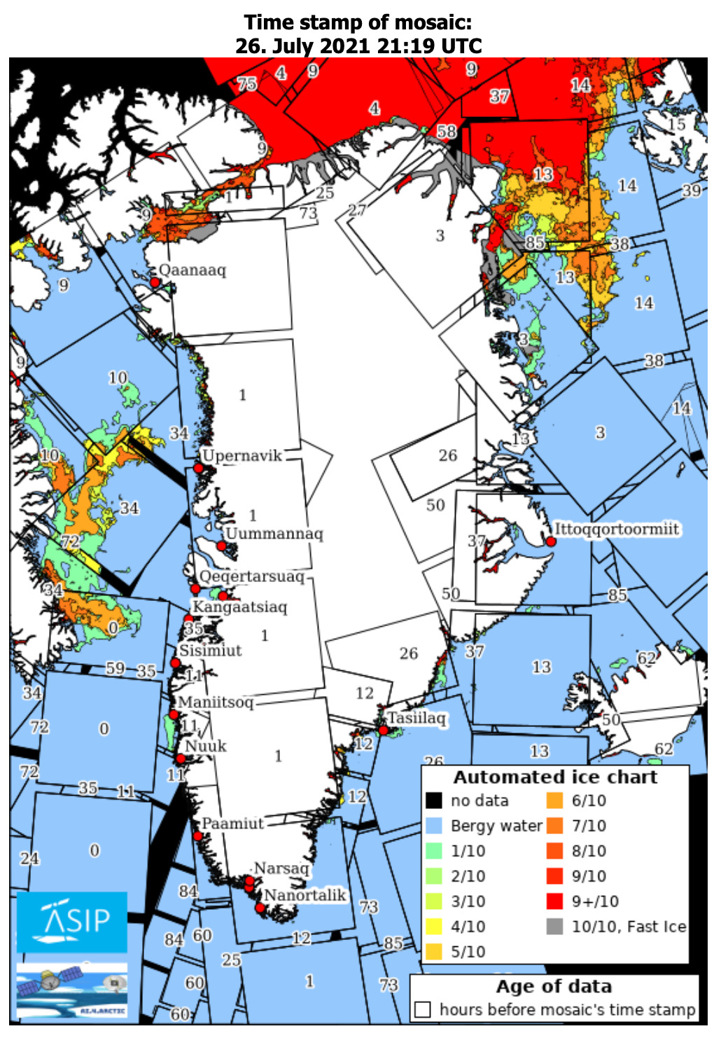
A recently completed research product led by the DMI, the Danish meteorological office, appears to have been able to do just that, in the process reducing the amount of time it takes to create an ice chart to 15 minutes after a new satellite image has been received.
In addition to being produced faster, the charts, known as ASIP, sort for Automated Sea Ice Products, have a higher resolution than charts produced by human hands alone do. This is because once computers have learned how to identify ice on an image and how it behaves, they can do it faster than a human can, which, in turn, allows charts to be made based on more of the ever-growing number of images being compiled by Earth observation satellites.
Training computers to identify sea ice in pictures first involved creating a program that compared past ice charts published by the DMI with the satellite images that had been used to create them.
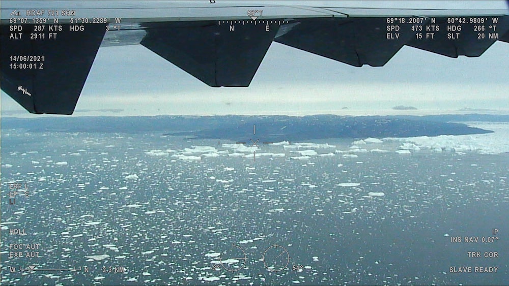
Later, real-world verification of the computer-assisted charts was carried out. This was done by dispatching Danish air-force jets and naval vessels to confirm that actual ice conditions matched what was on the charts, and that the charts were available quickly enough for them to be useful. In both cases, the results were promising, and the DMI says it expects to begin using the computer-assisted charts as part of its ice-forecasting.