Artificial intelligence could allow ‘new era’ for ice services in Greenland’s waters
Artificial intelligence is being eyed as a way to allow the Danish ice service to produce more frequent updates of sea ice in the waters around Greenland, improving maritime safety and making it easier for shippers to plan their routes.
Over the next three years, the DMI, the Danish weather service, will lead the 6.5 million kroner ($1 million) Automated Sea Ice Products project that will seek to use artificial intelligence to process satellite images to produce an initial version of a sea ice chart that the service’s employees can refine and publish.
Employing artificial intelligence, according to Matilde Brandt Kreiner, a geophysicist with the DMI, and the project’s leader, “marks the start of a new era” for sea ice services that would allow the DMI to more than quadruple the number of charts it puts out by making full use of the two EU Sentinel imaging satellites that pass over Greenland.
Currently, DMI staff produce several charts a week for the most travelled portions of Greenland’s waters by manually comparing multiple satellite images.
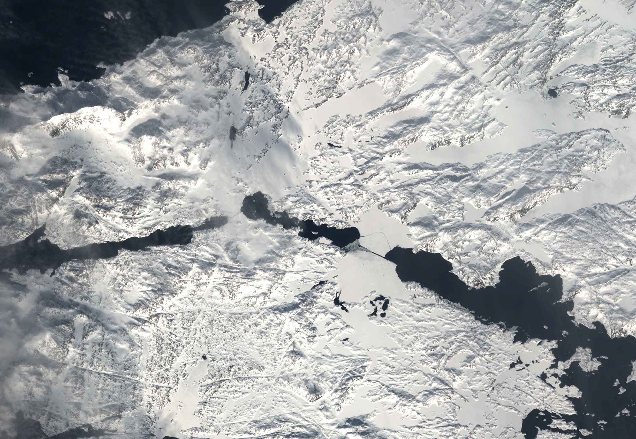
“This is the process we hope to replicate by training artificial intelligence to recognise the difference between ice and water and between different types of ice – thick ice, thin ice – so that it eventually can produce a first stab at an ice chart for us,” Kreiner said.
Training the computers the DMI will work with involves having them compare finished ice charts and the raw satellite images that were used to make them.
Ever since the DMI began relying exclusively on satellite images earlier this year, the limiting factor when it comes to providing more frequent updates of the fast-changing ice conditions that can see sail routes become impassable at less than a day’s notice has been the time it takes its staff to analyze images.
Previously, the DMI relied on observations from ships sailing in the area, as well as on its own aircraft. While weather conditions and darkness influenced whether observations could be made, the satellites are equipped with cloud-piercing radar that can record the island during their combined four flyovers each day.
The first maps are expected to be available to selected users in the summer of 2019.