Warming threatens some iconic permafrost landscape features
Pingos are important tundra landscape features, while the collapse of ice-wedge polygons could exacerbate environmental problems.
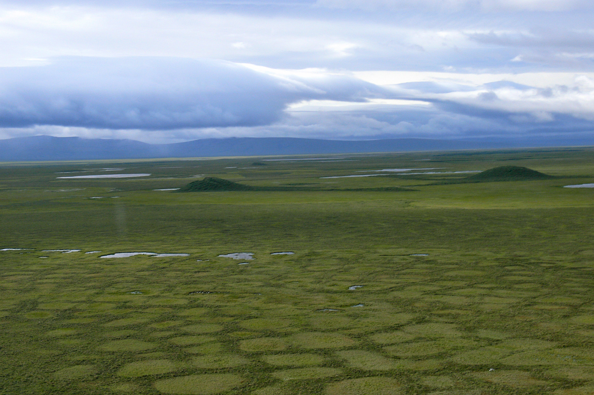
Pingos, the icy mounds that are iconic features of the permafrost landscapes, are at risk from climate warming, according to a new study by scientists in Finland, Germany and Alaska.
Permafrost thaw is expected to cause substantial loss of suitable conditions for pingos and two other types of features that bring texture to the permafrost landscapes: ice-wedge polygons and rock glaciers, according to the study, which published in the journal Environmental Research Letters.
If current levels of greenhouse gas emissions continue, those landforms are expected to lose about a third of their range across the northern hemisphere by mid-century, the study found. By the latter part of the century, between 2061 and 2080, more than half the range is expected to be lost if emissions continue at current rates, according to the study.
If emissions are reduced to a rate in line with the Paris climate agreement, however, the loss of range for pingos, ice-wedge polygons and rock glaciers is expected to be limited to about one-fifth, the study found.
The study said it is the first such projection for those three permafrost landforms
The losses could have cascading effects across large areas, the study said.
“The disappearance of iconic permafrost landforms is reducing geodiversity and potentially affecting biodiversity,” co-author Jan Hjort of the University of Oulu’s Geography Research Unit, said in a statement released by the Finnish university.
Pingos, which get their name from an Inuit word meaning “small hill,” are formed over hundreds of years of freeze and thaw. As ice accumulates into bumps, the pingos develop, rising as high as 70 meters. The Canadian Arctic is rich with pingos; the Mackenzie River Delta has the world’s largest concentration of pingos, but they’re found even south of the Arctic Circle in the discontinuous permafrost of interior Alaska, for example.
Pingos have served many functions. They are convenient lookouts for hunters. They provide prime nesting habitat for some birds and summer mosquito relief for caribou. They are refuges for plants. And they are also valuable archaeological resources.
A particularly famous pingo rises about 15 feet and is located at the Prudhoe Bay oil field on Alaska’s North Slope. Nicknamed “Mount Pingo,” it once inspired T-shirts and at least one ski “expedition” decades ago.
Ice-wedge polygons are also formed over hundreds of years of freeze and thaw. Wedges side by side/borders that hold standing water in the summer thaw season. With long-term warming, the active layer of soil — the soil that thaws in summer and freezes in winter — is deepening, causing the wedge polygons to collapse.
The ice wedges that underlie the polygons are melting across the Arctic, resulting in a variety of landscape changes, noted lead author Olli Karjalainen of the University of Oulu.
“Degradation can result in both wetting and drying of landscapes depending on local soil and drainage conditions. Wetting means formation of thermokarst ponds and lakes on thawing ice-wedge polygon landscapes, while drying occurs when meltwater from wedges drains from the site,” he said by email.
Rock glaciers are conglomerations of rock, ice and snow that are found in mountainous areas — in the Arctic and well south of it, in areas like the Rocky Mountains. Rock glaciers typically move slowly, but accelerated movement linked to permafrost thaw has been documented in places like the Alps and northern Norway.
According to the new study, the biggest driver for loss of habitat for pingos and ice-wedge polygons will be rainfall, projected to increase as temperatures warm. Results showed that the “sensitivity of pingos and ice-wedge polygons to the amount of rainfall was unambiguous,” though for polygons, the increase in air temperature as measured by thaw degree days was of equal importance to rainfall, the study said.
For rock glaciers, rising air temperatures will be the biggest driver of loss, the study said; “air temperature and topography primarily controlled the occurrence potential,” it said.
The loss of areas suitable for pingos and wedge polygons expected to be most concentrated in northwestern Russia and the middle reaches of major Arctic rivers, according to the study. For rock glaciers, the losses are expected to be concentrated in areas of discontinuous permafrost, according to the study.
But in some regions, the conditions for these permafrost-related features is expected to increase as part of a northward shift, according to the study. For pingos and ice-wedge polygons, suitable conditions are expected to expand in places such as Canada’s Arctic Archipelago and Russia’s Taymyr Peninsula, the study said. For rock glaciers, supportive conditions are expected to improve in northern Alaska, high-Arctic Canada, eastern Greenland and the Russian Far East, the study said.