U.S. Coast Guard launches its first satellites, with an eye on Arctic security
The Coast Guard recently launched two small satellites for new search-and-rescue efforts in the Arctic — with the potential to improve domain awareness and communications as well.
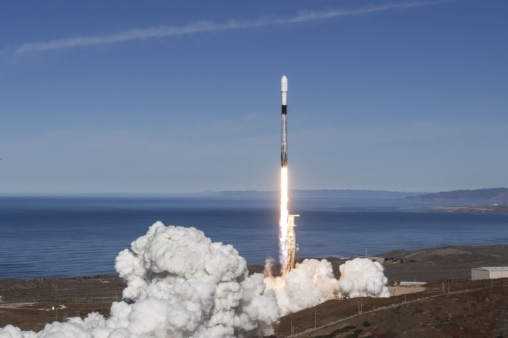
On Monday last week, the U.S. Coast Guard launched its first satellites into space. By Tuesday, operators had already successfully detected signals from the two small satellites, named Kodiak and Yukon.
These CubeSats, about the size of shoeboxes, are part of the Polar Scout mission, undertaken with the Department of Homeland Security.
Kodiak and Yukon were among 64 other small satellites and CubeSats from 17 countries catching a ride on SpaceX’s SmallSat Express — the largest rideshare mission ever from a U.S. launch.
Adm. Karl Schultz, commandant of the U.S. Coast Guard, touted this mission in a discussion on Arctic security at the Woodrow Wilson Center last week.
“Just yesterday, we ventured into space,” he said. “The Polar Scout initiative should also provide valuable insight on the process, cost, and feasibility of acquiring and using organic satellites to enhance mission capability in the Arctic.”
The satellites will pass over the North Pole 15 or 16 times a day for about 12 minutes at a time, providing a total of about three hours of daily Arctic coverage from each satellite.
The satellites are expected to stay in orbit about two to three years. During that time, the Coast Guard will run tests to detect the emergency position-indicating radio beacons (EPIRBs) deployed during search and rescue operations. The tests will begin in early 2019 and continue through the summer.
Although their path is focused around the Arctic, they are able to detect the signals anywhere along that path, and the Coast Guard intends to send test beacons from the Atlantic and Pacific regions, too.
And if they happen to pick up real distress signals, the Coast Guard will coordinate a response, said lieutenant commander Grant Wyman, the agency’s lead project manager of this initiative.
If this mission proves successful, Adm. Schultz said, future satellites could help with more than search and rescue.
“We’re hoping the use of such satellites may help improve communications,” he said. “Also, they’ll assist in monitoring large areas for illegal activity, and help assist mariners in distress.”
Although these CubeSats are only programmed to receive distress signals, future satellites could receive and transmit other radio signals, as well as radar, communications, and even images.
Currently, the Coast Guard relies upon 20-year-old technologies for search and rescue, with radio communication and some limited satellite capabilities in the Arctic.
Communications in the Arctic, with its harsh conditions, large area, and relative lack of infrastructure, have been difficult to build up.
“It would vastly improve Coast Guard capabilities in the Arctic,” Wyman said. “That’s one of the areas right now where we’re looking to increase maritime domain awareness.”
The CubeSats can download data to two ground control stations — one at the Coast Guard Academy in New London, Connecticut, and one at University of Alaska Fairbanks. About 85 researchers in New London’s research and development lab work on this project.
There are, of course, challenges to using small and somewhat limited satellites. CubeSats are more affordable because of their small size. But more complicated missions — like improved communications — would likely require larger satellites.
“The biggest impact is the launch cost,” Wyman said. “The heavier it is, the more expensive it is.”
In addition to evaluating how CubeSats might help Coast Guard operations, this mission will also help the Coast Guard determine how best to partner with other agencies and with private companies.
“There are a number of companies that have CubeSats up there now, or are planning to launch CubeSats, that do all sorts of earth observation missions — and you just buy the data where and when you want it,” Wyman said.
In that case, the Coast Guard wouldn’t even need to shell out the cash (about $25,000 for a standard CubeSat) for the satellites themselves — they’d just rent the data from a satellite already in orbit.
“We’re at the point now where we can actually compare,” Wyman explained. “We have our own satellites in orbit, and there are a number of companies that are selling similar data.”
Captain Greg Rothrock, commander of the project, calls this mission a “great opportunity” for improving the Coast Guard’s work in the Arctic and elsewhere.
“I think this is a great first step,” he said. The barriers to operating in space are being lowered because of new technology, he said; such a mission wouldn’t have been feasible even 5 years ago.
Does this mean the Coast Guard is becoming the United States’ next space agency?
“I would love to see that!” Wyman said. “It definitely offers a lot of advantages to conducting many of our missions. You can cover a lot more ground more quickly and more thoroughly with a satellite.”
For now, they’re celebrating the Coast Guard’s first step into outer space.
“It’s a monumental day that they both got into space, and they both turned on,” Rothrock said. “That’s a big deal.”