This year’s Arctic sea ice melt season is off to an unusually fast start
“All else being equal, this summer could see a tremendous amount of ice loss.”
For every day of April, Arctic sea ice extent was at or near record lows for this time of year, continuing a recent pattern and helping launch a fast start to the summer melt season.
The average Arctic sea ice extent for April was just 20,000 square kilometers (7,700 square miles) more than that posted for the same month last year, the National Snow and Ice Data Center reported. The margin is close enough to consider 2018 and 2017 tied for lowest April extent, the Colorado-based center said.
More ominously, winter sea ice is now thinner than it was just a few years ago. A new study led by NSIDC scientist Julienne Stroeve found that ice thickness was probably reduced by 11 to 13 centimeters (4.3 to 5.1 inches) in the warm winter of 2016-17 from the mean thickness of the years from 2011 to 2017. That winter posted the fewest freezing days above Latitude 70 since satellite records began in 1979, said the study, published in the journal Cryosphere.
The relationship between ice growth and winter chill also appears to be weakening, with ice growth decreasing since 2012 as winter air temperatures have increased and freeze-up has become later, Stroeve’s study said.
A similar thickness analysis is being done for the past winter, but results are not yet available, the NSIDC said. It is clear that this winter’s sea ice coverage is weaker than that of winters in the past. Pushed in large part by lack of ice and a relatively warm and stormy season in the Bering Sea, total Arctic winter coverage in March hit the second-lowest winter maximum on record, after that of last winter.
Ice extent in the Bering Sea was at record lows — by a vast amount — and by the end of April, ice there had almost disappeared entirely. “It’s been crazy,” said NSIDC director Mark Serreze.
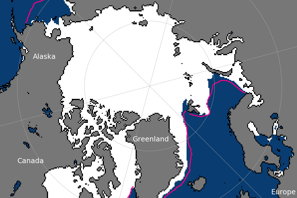
Conditions in the Bering affected the Chukchi Sea north of the Bering Strait, Serreze said. There is a warm water flux northward through the strait that appears to have grown in intensity over the past years, he said.
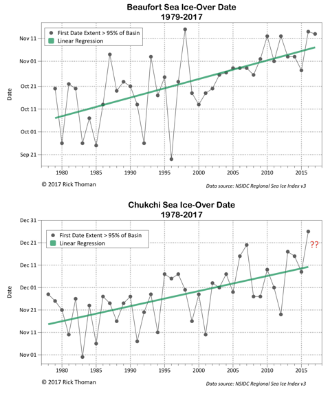
There is already a big section of open water the Chukchi, according to NSIDC information. Thaw this year began in the second half of April, far earlier than the May thaw start in every other year, including last year, according to the data. That followed a much-delayed Chukchi freeze-up; full freeze-up did not occur until about the New Year holiday, a record late date. Until the mid-1990s, the Chukchi was reliably frozen over by the end of November, according to NSIDC records.
Conditions have combined to set up a powerful melt, Serreze said.
“That is putting us in a very bad hole right now,” he said. “All else being equal, this summer could see a tremendous amount of ice loss.”
Where the ice winds up after the melt season will depend a lot on the weather to come, but a new record low is possible, Serreze said. “At some point, we’re going to have another year like 2012,” he said.
That year saw the lowest sea ice extent recorded since satellite measurements began in 1979.
Yereth Rosen is a 2018 Alicia Patterson Foundation fellow.