Russia and Norway exchange seismic data
Norwegian and Russian petroleum authorities have agreed to exchange seismic data from the areas around the maritime boundary in the Barents Sea.
“This is a very important agreement; it makes it possible for us to get a better understanding of the regional geological conditions on both sides of the boundary, and – not least – the geological structures that cross the boundary,” says Stig-Morten Knutsen, assistant director of exploration at The Norwegian Petroleum Directorate.
The agreement was initiated by Rosnedra, the Russian Federal Subsoil Resources Management Agency, and was signed this July by Bente Nyland, Director General of the Norwegian Petroleum Directorate, and Evgeny A. Kiselev, Director of Rosnedra.
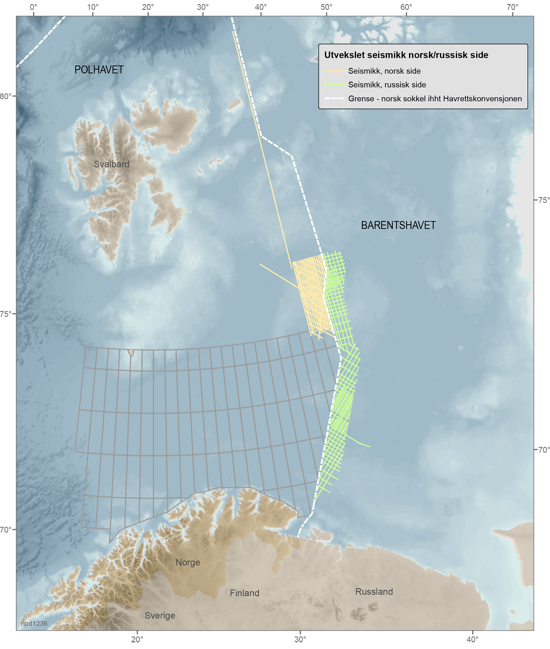
Russian and Norwegian authorities will exchange approximately equal amounts of data. Russia will share all seismic data collected in 2013 in two major licenses: the Fedynsky license and the central Barents Sea license, in a zone that is 50 kilometers (about 31 miles) from the demarcation line. There will also be a line from the gas discovery on the Kildinskoye High. In total, the NPD has received 2D seismic data for 6,500 square kilometers (about 2,500 square miles) of from these areas.
Rosnedra has received 2D seismic data for about 5,900 square kilometers (about 2,280 square miles) of the Norwegian side. This includes seismic data that the NPD collected in the northern Barents Sea in 2012, 2013 and 2014, limited to east of 35°E and south of 76°10N. The Russians will also receive a seismic line from the stratigraphic boreholes on the Sentralbank High, as well as a long line that spans north to south in the Arctic Ocean.