Researchers recommend a warning system for Greenland hamlets flooded by 2017 tsunami
A future landslide could cause waves up to three times larger than the one in 2017 that killed four and forced two hamlets to be abandoned.
The calculations are highly uncertain, but the recommendation is clear: A warning system could spell the difference between life and death for residents of the hamlets along a Greenland fjord system flooded by a 2017 tsunami that claimed the lives of four people.
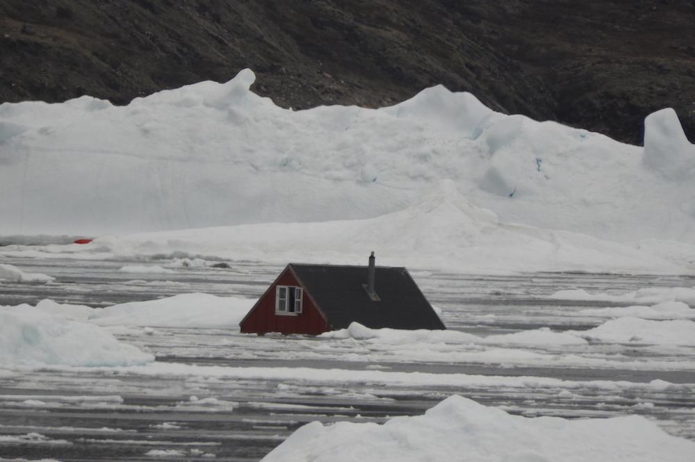
In the hamlet of Illorsuit, whose 91 residents found themselves in the path of the 2017 tsunami, such a system could save lives by giving residents between 5 and 10 minutes to reach higher ground, according to Asiaq Greenland Survey, a nationally controlled geologic research service.
The June 17, 2017, landslide in Karrat Fjord created a wave that, at its peak, rose to a height of 100 meters. By the time it reached the closest hamlets, Nuugaatsiaq (pop. 84) after 7 minutes and Illorsuit after 12 minutes, it had dissipated considerably, falling to 9.3 meters and 2.7 meters, respectively, but, in both cases, the destruction was significant enough that residents had to be evacuated. Today, they remain uninhabited. That’s because an adjacent section of mountainside, known as Karrat 3, that is 10 times more massive than the section that gave way is 2017 is also at risk of collapsing into the fjord.
[The site of a 2017 landslide and tsunami remains a ‘danger area,’ say Greenland authorities]
Asiaq Greenland Survey’s estimates of how much of the mountainside could fall vary, just as it says there is no way to tell whether it would happen gradually or in one catastrophic event. Still, its most conservative estimate is that Illorsuit could expect wave heights of at least 2.7 meters. In the worst-case scenario — which Asiaq Greenland Survey underscores is only a theoretical possibility, given the geology and slope of the mountainside — wave-height could reach 8.7 meters.


The estimate for wave-heights at Nuugaatsiaq range from 13.2 meters to 28.4 meters. (The videos below depict the speed and heights of waves caused by various landslides.)
Time of year would also be a factor: a landslide onto solid sea ice would, scientists reckon, generate smaller waves than a landslide into open water — though experiments that could indicate what the specific effect still need to be carried out.
[Greenland is considering wave-proofing two ports that are exposed to local tsunamis]
Further along the fjord, five other hamlets, as well as the town of Uummannaq (pop. 1,500), would see rising water levels within 25 to 42 minutes of a landslide taking place. Even with a middle-of-the-road estimate, water levels could reach heights deemed dangerous to properly and human life, though for the most part the risk would be to the former and could be addressed through a combination of preparation and a warning system, according to Asiaq Greenland Survey.
Residents of the two abandoned hamlets have repeatedly requested to be allowed to return home, but national officials say the findings, uncertain as they are, show that the danger of a tsunami persists.
A thorough study of the potential danger is due in March, when GEUS, the geological survey of Denmark and Greenland, is expected to complete further studies of Karrat 3.
Until then, local and national authorities will be helping residents to organize watches that can hold an eye on water levels around the clock.