With marine traffic growing, international shipping agency approves US-Russia plan for Bering Strait shipping lanes
The final proposal also sets up buffer zones around three sensitive Alaska islands.
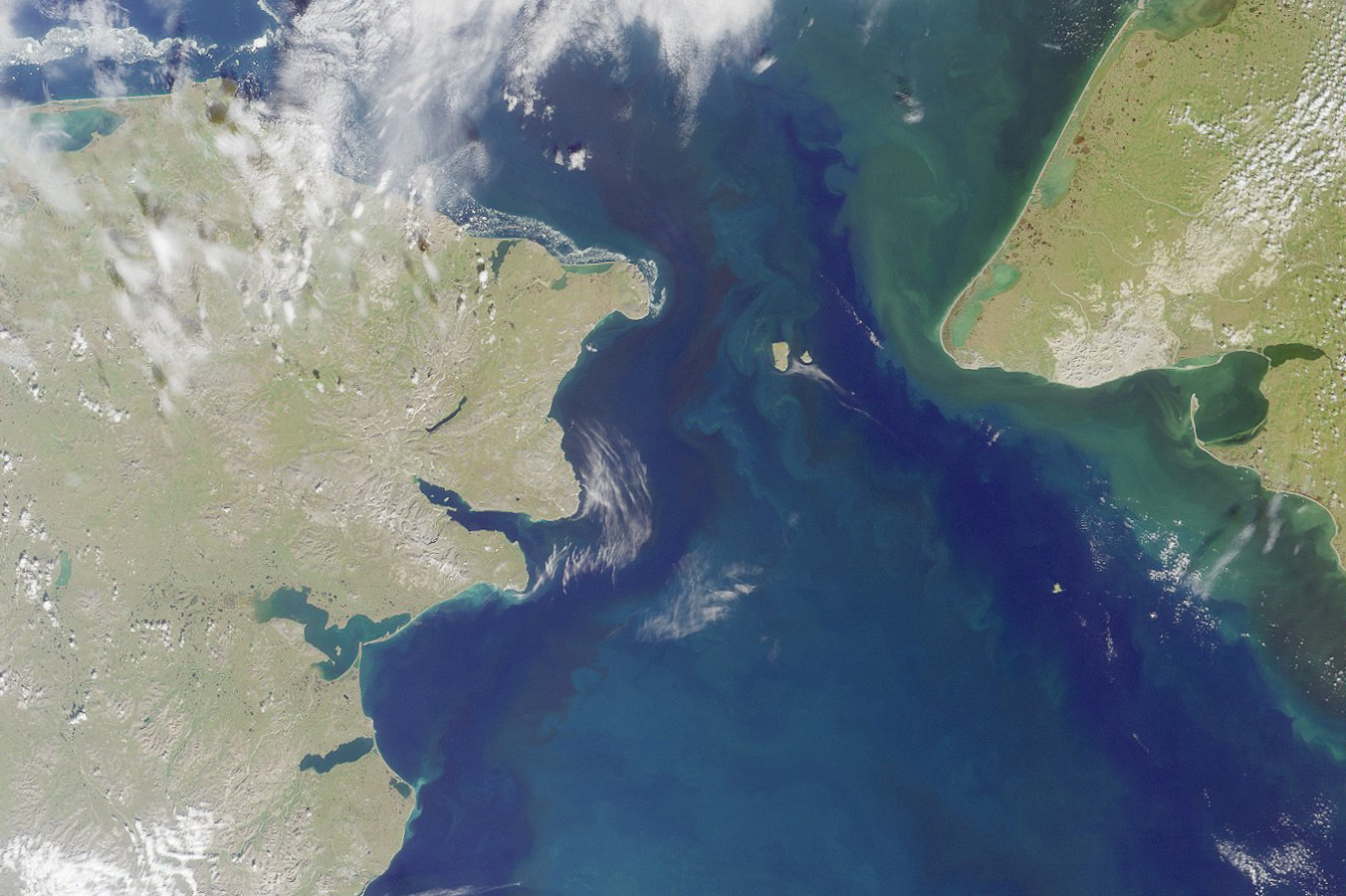
The Bering Strait, where vessel traffic is increasing as Arctic sea ice retreats, will have designated shipping lanes and island buffer zones to protect the marine environment and the people of the region.
The International Maritime Organization announced Friday that it has given final approval a joint U.S.-Russian proposal to designate two-way shipping lanes for vessels that are at least 400 gross tonnes. In addition, the IMO approved a U.S. proposal to establish “areas to be avoided” designations for three Alaska islands in the Bering Sea — King Island, St. Lawrence Island and Nunivak Island. The designations go into effect in December.
The IMO’s action, which has gone through several steps, helps protect the region, said a representative of a Bering Sea Native organization that has long advocated for better shipping safety.
“I think it’s a wonderful accomplishment,” said Austin Ahmasuk, marine advocate for Nome-based Kawerak Inc., a nonprofit owned by Inupiat people of the Bering Straits region.
[Joint Russia-US proposal calls for Bering Strait shipping lanes]
Ahmasuk and other Alaska Native representatives have been working for years to establish designated shipping lanes and other safety measures in and around the narrow passage that separates Alaska and Russia and leads to the Pacific side of the Arctic Ocean. It has been a difficult task in some ways, he said.
“Indigenous folks in the Arctic, whether it’s in the U.S. or Canada or in Greenland, we don’t have a formal seat at the International Maritime Organization,” he said. To advocate at the IMO, a United Nations organization, Indigenous groups have had to rely on their own nations’ governments or on nongovernmental environmental organizations that do have status to negotiate, he said.
Ship traffic in the region is on the rise as industrial and commercial activities and tourism expands. Bering Strait transits totaled 220 in 2008 but rose to 540 in 2015, according to a Bering Strait, Chukchi Sea and Bering Sea port access route study published by the U.S. Coast Guard in 2016.
“We have observed a steady increase in Arctic shipping activities over the last decade, and these routing measures were jointly developed in response to this increased activity,” Mike Sollosi, the chief of the U.S. Coast Guard Navigation Standards Division, said in a statement.
Those increases are expected to continue. A 2015 report prepared for the Coast Guard, Department of the Interior and other government agencies predicted that by 2025, vessel transits through the Bering Strait would increase by 430 percent from 2013 levels.
For Indigenous people in the region, Ahmasuk said, growing vessel traffic raises concerns about oil spills, waste discharges and impacts to wildlife from vessel strikes, introduction of invasive species and disease pathogens and other disturbances.
Already, there are some apparent impacts, he said. In 2016, an oil-bearing tanker grounded off Nunivak Island, for example. And in 2013, a Stejneger’s beaked whale was found dead on the beach near Gambell on St. Lawrence Island; it was the northernmost known stranding for that whale species, and analysis of the carcass suggested that “severe acoustic exposure” had prompted a too-fast rise from depth and caused the whale’s death. There is evidence of harm to mammals from fishing gear as well; in 2015, a dead bowhead whale, entangled in fishing line, was found on the north shore of St. Lawrence Island, according to a report from the National Oceanic and Atmospheric Administration.
Establishment of shipping lanes and buffer designations does not address all those concerns, but it marks important progress, Ahmasuk said.
Environmental concerns identified by the IMO include the potential for oil spills, disturbances to seabird colonies and interference with Native subsistence activities.
The vessel traffic lanes system encompasses six two-way segments and six precautionary areas.
The vessel traffic lanes and avoidance areas are not mandatory, but they are likely to be followed because shippers’ insurers are expected to demand compliance, Ahmasuk said.
The IMO established similar rules in 2015 for the Aleutian Islands, setting up five areas to be avoided around ecologically sensitive island groups. Those designations, also voluntary, went into effect at the start of 2016.
Pacific Environment, one of the nongovernmental organizations that works with Kawerak and other indigenous groups, on Friday celebrated the new Bering Sea protections.
“The fragile Arctic needs special protections like these to defend it against the many looming harms of increasing ship traffic,” Kevin Harun, Pacific Environment’s Arctic program director, said on the organization’s website.
Now Pacific Environment and its allies are advocating for additional protections north of the Bering Strait in the Chukchi and Beaufort seas, Harun said.