Land at a strategic Bering Strait deepwater site has been transferred to an Alaska Native corporation
Port Clarence, site of a former Coast Guard navigation site, is a rarity in the Bering Strait region — a natural deepwater port.


A strategic sliver of land newly transferred from the federal government to Native ownership is being touted as an important element of future safety improvements for Bering Strait marine traffic.
About 2,200 acres of land bordering a sheltered bay northwest of Nome was formally transferred by the U.S. Bureau of Land Management to the Inupiat-owned Bering Straits Native Corp. The site, called Point Spencer, is a long spit that partially encloses and shelters Port Clarence, a Bering Strait-area bay with deep water, a rare quality in that region.
The move comes alongside a renewed push for one or more U.S. Arctic deepwater ports, including language in the most recent defense spending bill.
The land transfer makes good on a promise made in a 2016 act of Congress that outlined a plan for converting the uninhabited area into a support center for modern maritime business in the Arctic. The U.S. Coast Guard Authorization Act of 2016 has a section directing the federal government to transfer to BSNC and possibly the state of Alaska land that, until recently, was used by the Coast Guard for a now-shuttered navigational station.
[A new U.S. defense bill could require plans for an Arctic strategic port, missile warning upgrades]
There is a “compelling” need for permanent development at the site to support marine safety, Arctic research, preservation of Indigenous culture and other purposes, the 2016 act said. “It is in the national interest to develop infrastructure at Point Spencer that would aid the Coast Guard in performing its statutory duties and functions in the Arctic on a more
permanent basis and to allow for public and private sector development of facilities and other infrastructure to support purposes that are of benefit to the United States,” the act said.
For the BSNC, the official transfer is an important step toward improving marine safety while expanding economic opportunities.
“As our country prepares to defend our shores in the Arctic, we hope that this port will once again stand as a beacon of safety and security in service to our great nation,” Gail Schubert, BSNC’s president and CEO, said in a statement.
The existing port of Nome is considered by federal officials to be the most likely spot for a full-service U.S. Arctic port. The U.S. Army Corps of Engineers has approved a port expansion plan at Nome that would take advantage of the city’s commercial centers, airport, health-care facilities and other amenities.
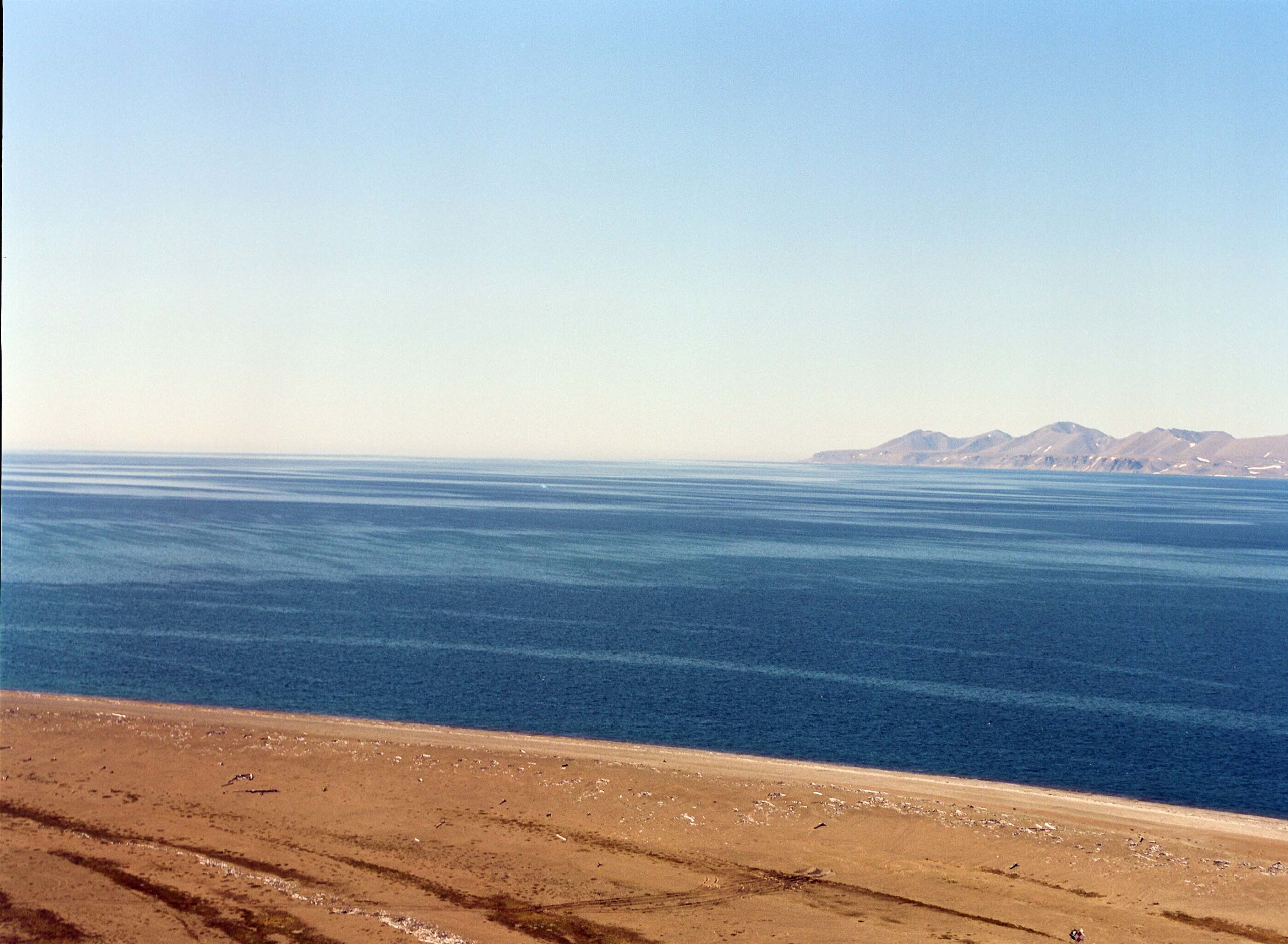
But Port Clarence, partially isolated and about 65 miles northwest of Nome, has qualities that could also support Bering Strait marine traffic.
Its waters are naturally deep, generally extending to at least 35 feet and, in some places, to 50 feet — depths that could accommodate deep-draft vessels, unlike those at Nome, which would have to be dredged. Port Clarence’s partially enclosed configuration provides a natural shelter against harsh weather.
And Port Clarence has a long history of serving as a gathering spot and refuge for mariners.
Long before European contact, it was serving as a rendezvous site for traders from either side of the Bering Strait. When Russian fur traders arrived, they used it too, as did commercial whalers of the 19th century. It even played a bit part in the saga of the Franklin Expedition, a doomed attempt to find the Northwest Passage over the top of North America. One of the ships dispatched to search for the missing Arctic explorers spent the winter of 1853-54 in sheltered Port Clarence, part of a series of historic events described by Arctic expert John Bockstoce in his book “Furs and Frontiers in the Far North.”
More recently, Port Clarence was home to a Coast Guard Long Range Aids to Navigation (LORAN) station, one of a string of far-flung navigational stations that became obsolete in the GPS era. The Coast Guard decommissioned the Port Clarence station in 2010, but it left some infrastructure that could be useful in the future.
That includes an 8,000-foot airstrip that is located on the Point Spencer property acquired by BSNC.
After this first land conveyance, an additional 200 to 300 acres may be transferred to BSNC in the future, Miriam Aarons, the corporation’s communications director, said by email. That would happen after the Coast Guard completes its environmental assessment at the site, she said.
Ultimately, the Coast Guard is expected to retain some land in the area to use for its future Arctic operations, BSNC said in its statement.
BSNC has already done some preliminary maritime-support work at Port Clarence. A corporate subsidiary, Inuit Services, in 2016 brought moorings there to help ships that might use the site for stopovers.
BSNC hopes to have the mooring systems set next summer and is seeking federal assistance and possible grants to accomplish that, Aarons said. “BSNC feels that this is a small but vital improvement to marine safety” she said by email. “Port Clarence is the only natural deep-water port of refuge in the American Arctic. The moorings may serve to secure vessels while lightering fuel, or by vessels in the event of emergencies, such on-board fires, loss of operating power, or some other potential disaster.”