Canadian Arctic shipping traffic nearly tripled over 25 years
Cargo ships and government vessels (including icebreakers) make up the bulk of the traffic, but the percentage of pleasure craft is growing rapidly.
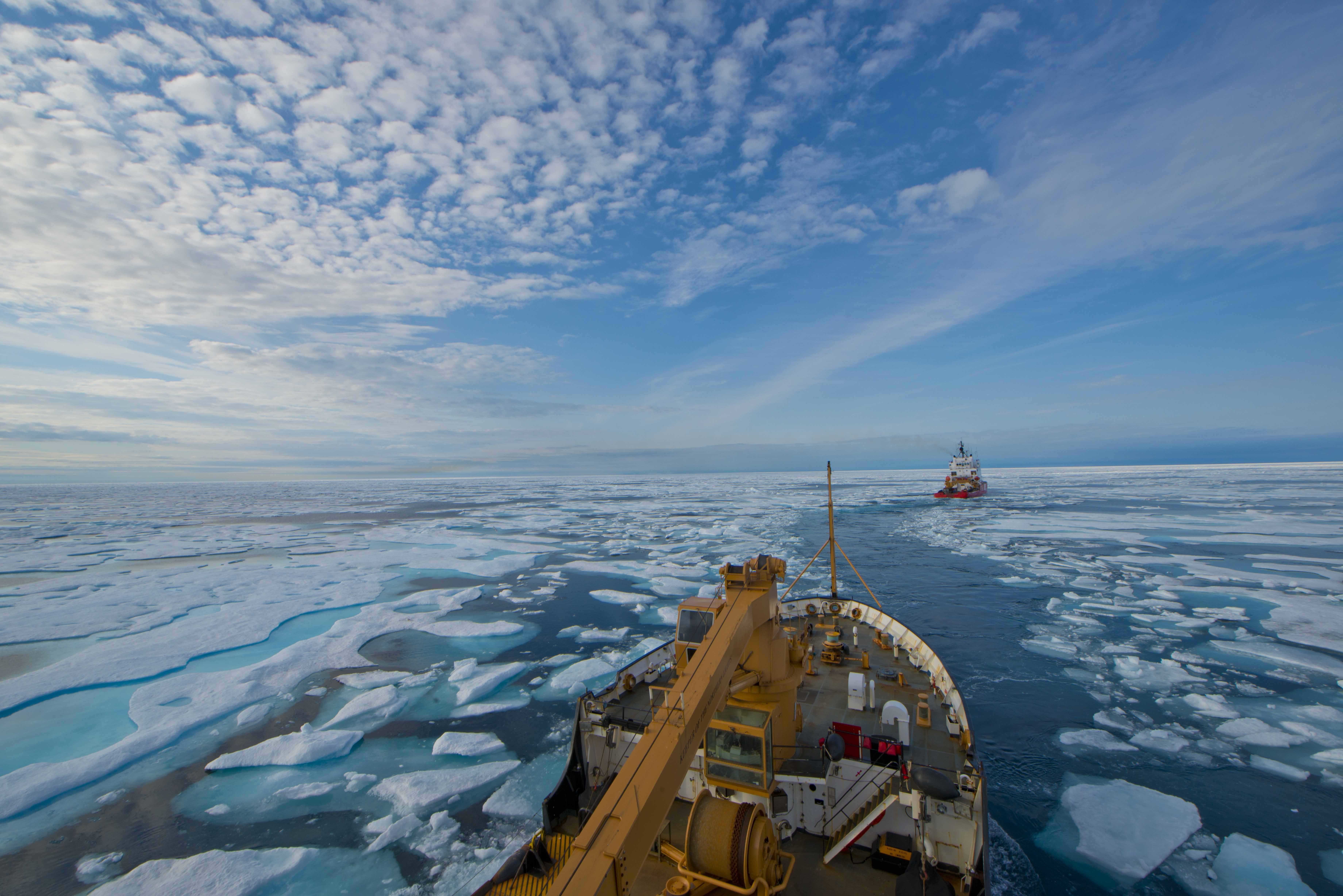
A new study on shipping in Canada’s Arctic has found that traffic in the region almost tripled between 1990-2015.
The researchers found that the annual distance traveled by all vessels grew from about 350,000 kilometers to more than 900,000 kilometers with the majority of growth occurring over the past decade.
Cargo ships as well as government vessels, including icebreakers, account for the largest share of traffic while pleasure craft, primarily private yachts, represent the fastest growing type of craft increasing more than 20-fold over the 25-year period. This rapid growth in adventure tourism-related shipping activity represents a unique challenge to safety of navigation along the route.
“It is pleasure craft that concern me the most. Harsh and unpredictable weather can always be a risk – and this combined with variable ice conditions can pose serious safety and navigation risks along the Northwest Passage,” explains Jackie Dawson, lead author of the study, associate professor at the University of Ottawa and Canada Research Chair in Environment, Society and Policy.
Differences between Arctic shipping routes
The results of the study highlight the distinct differences in vessel traffic along the Arctic’s two primary shipping routes. In contrast to Russia’s Northeast Passage, also known as the Northern Sea Route, where natural resource extraction and related activity are the primary reasons for growing traffic, the main drivers in Canada’s Arctic are tourism and re-supply, e.g. local construction and development, according to Dawson. “Right now natural resource development is not the main driver for increased shipping traffic in Arctic Canada.”
On the other side of the Arctic Ocean, Russia has begun to develop the NSR as a resource export route to deliver Arctic oil and natural gas to markets in Europe and Asia. Traffic volume, largely driven by deliveries from Yamal LNG, is expected to double over the next few years and additional projects, such as Arctic LNG 2, are already being planned.
“The Northeast Passage is more viable in the short-term future. The ice is less dynamic and more predictable, there are more infrastructure and services, and the commercial opportunities (for some) make much more sense. Insurance also plays a major role,” explains Dawson.
Nonetheless significant potential for growth exists along Canada’s Northwest Passage. While the NWP may never be able to compete with the NSR in terms of trans-Arctic shipping, there are opportunities for improved access to Canada’s Arctic waters, the researchers conclude. And depending on ice and market conditions as well as federal and local policy positions natural resource development could increase and drive additional traffic in the future, states Dawson.
Overcoming lack of data
The study represents the first spatial and temporal effort to paint a comprehensive look at how traffic along the route has changed since 1990. For this purpose the scientists looked at overall activity, vessel types, the spatial distribution — i.e. where ships travel in the Arctic — and their proximity to local communities. In total the study distinguishes between ten different types of vessels, including cargo vessels, government ships, container ships, tankers and passenger ships.
The researchers had to overcome data scarcity and used a combination of Automatic Identification System data, available since 2010, and daily ship location reports from the Canadian Coast Guard archive. The study looked at the northern deep-water route of the NWP through the Parry Channel and the M’Clure Strait, the southern shallow-water route to the south of Victoria Island as well as the Arctic Bridge route connecting Europe to the Port of Churchill, Manitoba in the Hudson Bay.
Rapid growth since 2007
The study identified four distinct periods of shipping traffic in the region. During the baseline period from 1990-2000 very little growth was recorded. Similarly, during the next period from 2001-2005 growth was still very limited. In contrast rapid growth occurred between 2006-2010 in which traffic grew more than two-thirds over the baseline period and this growth continued during the last period from 2011-2015.
Cargo vessel traffic in particular has seen an increase since 2007 when the NWP was ice-free for the first time since satellite observations began in the 1970s. And while annual variations in traffic volume remain, the study shows that the Canadian Arctic has seen a significant increase in shipping activity over the last quarter-century.
In addition to an overall growth in traffic, the researchers were able to conclude that some types of vessels have experienced more growth than others. In 1990 general cargo ships accounted for 28 percent of traffic, followed by government vessels and icebreakers (25 percent), bulk carriers (20 percent), and tanker ships (14 percent). Fishing and pleasure craft represented just 5 percent and 1 percent, respectively. By 2015 the share of fishing vessels and pleasure craft had increased to 15 percent and 8 percent of total vessel traffic.
Ships venture into new waters
The researchers were also able to identify a number of trends in the spatial distribution of vessels in the study area, e.g. fishing vessels operate almost exclusively southeast of Baffin Island and bulk carriers are primarily found along the Arctic Bridge route. Overall the majority of vessels operate along the southern NWP where ice conditions are more favorable. The northern waters of the NWP are almost exclusively reserved for government vessels and icebreakers.
The exception are pleasure craft which are now prevalent throughout the Canadian Arctic. Whereas a small number of pleasure craft operated exclusively along the NWP’s southern channels in 1990, they are now common along all sections of the route, including waters in the far north and on the western side of Baffin Island. “These vessels tend to travel off of the main shipping corridors where charting is poor and where services are less available,” cautions Dawson.
Shipping corridors enhance safety
A key aspect to ensuring and enhancing safety of navigation along the route as well as Arctic waters in general will be the establishment of shipping corridors. “A corridor approach that is linked internationally will enable government and industry to prioritize investments and ensure these focused areas are well charted and well serviced,” affirms Dawson.
Such an initiative was recently jointly proposed by the United States and Russia for vessels passing through the Bering Strait and Bering Sea. The scheme aims to organize and direct ships along fixed corridors passing through the Bering Strait.
In contrast to the NSR where rapid growth in shipping traffic precedes the establishing of robust rules — last year nearly 100 vessels along the NSR violated the rules of navigation — the lingering ice along the NWP and fewer commercial drivers enable Canada to put into place strong protections for the environment, sailors and communities along the route before large-scale commercial activity. “Canada currently is being afforded the time to ensure robust and cooperative protection measures and management strategies for dealing with increased maritime activity in the NWP and region in general,” concludes Dawson.