An aggressive new Trump administration plan opens more of Arctic Alaska to oil development
The controversial plan ends Obama-era protections in some ecologically sensitive parts of the National Petroleum Reserve in Alaska.


The Trump administration on Thursday released a plan to vastly expand oil development in federal lands on Alaska’s North Slope, upending Obama-era protections.
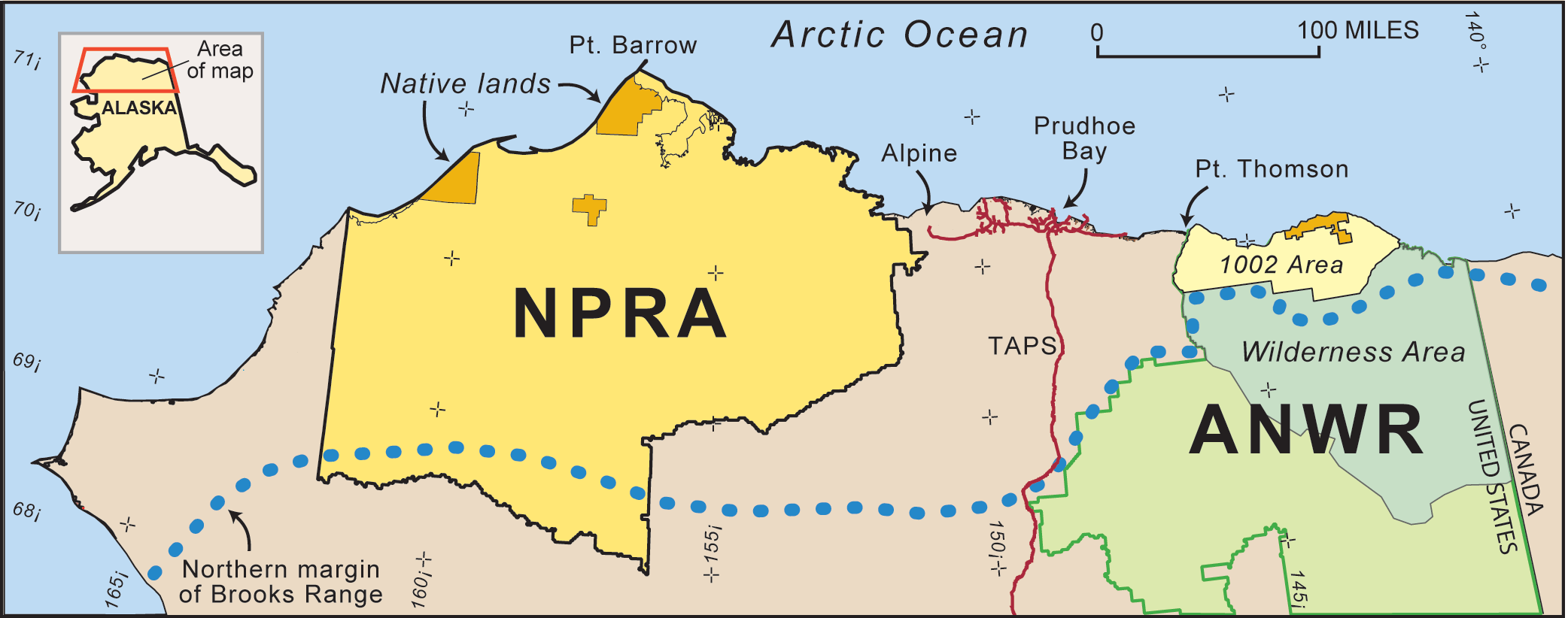
In a final environmental impact statement for a new integrated activity plan, the Interior Department’s Bureau of Land Management selected a preferred alternative that would allow oil development on 18.7 million acres of the 23 million-acre National Petroleum Reserve in Alaska, or NPR-A.
The Trump administration’s rewrite of the Obama-era Integrated Activity Plan for the petroleum reserve, when it goes into effect, will open about 7 million more acres to oil development.
Administration officials said the plan makes good on pledges to boost domestic energy production.
“President Trump has committed to expand access to our Nation’s great energy potential,” Interior Secretary David Bernhardt said in a statement. “Today’s action is one more significant step in the process of delivering on his promise.”
“We’ve looked to open up some additional areas to leasing based on new information while also using management prescriptions to protect important wildlife, habitat, and subsistence uses,” Chad Padgett, the BLM’s Alaska state director, said in the statement.
Under the Obama administration plan, oil development was allowed on about half the reserve, and the other half was put off-limits for environmental and cultural reasons.
The process to end Obama-era protections began at the start of the Trump administration when then-Interior Secretary Ryan Zinke issued an order to open more of Arctic Alaska to oil development. The 2017 order included other hot-button areas along with NPR-A: the Arctic National Wildlife Refuge and offshore Arctic Ocean waters. Congress in late 2017 authorized oil development in the wildlife refuge, but the Trump administration has yet to schedule a lease sale there. Efforts to lease vast stretches of the Arctic Ocean were blocked by a 2019 federal court ruling.
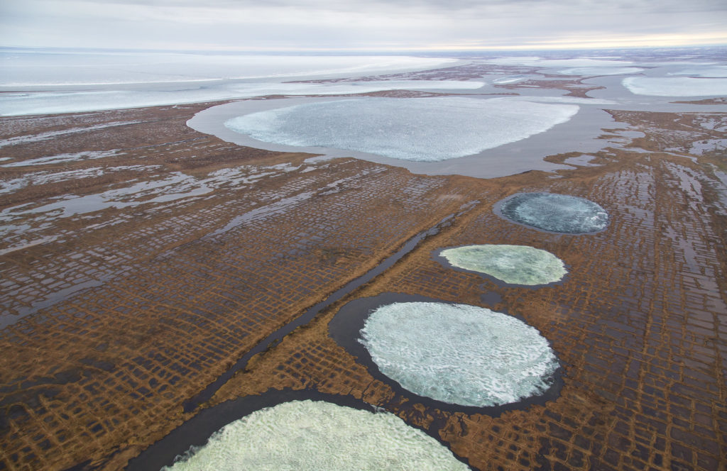
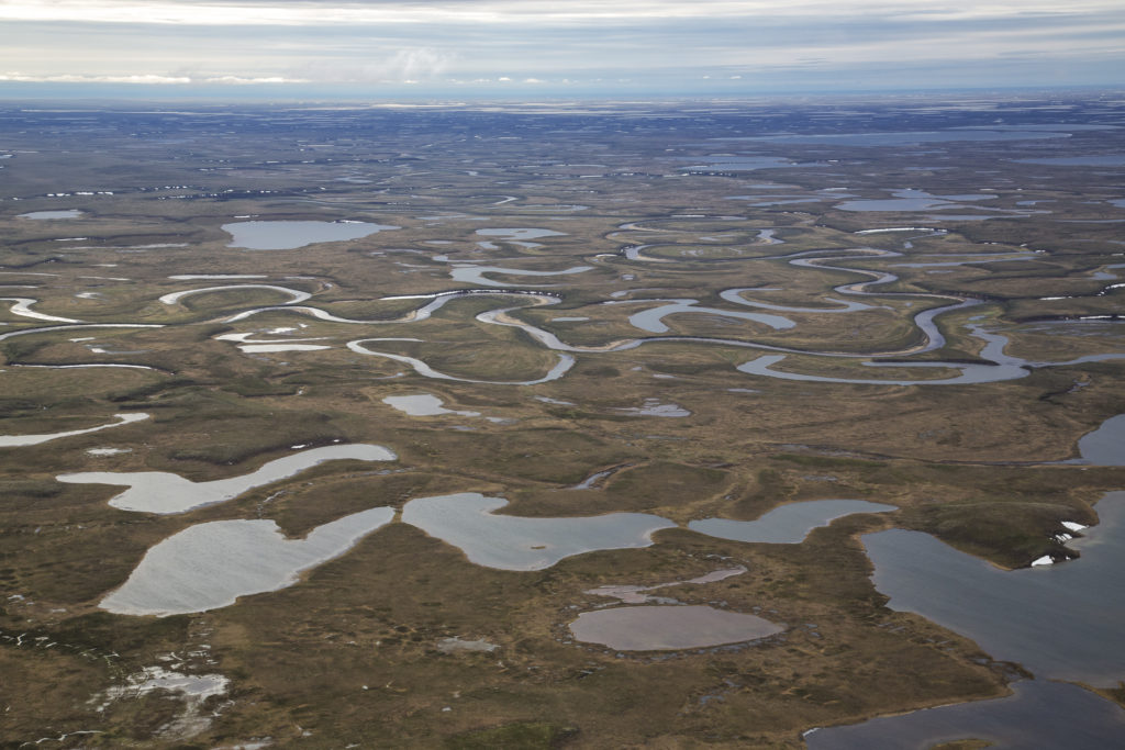
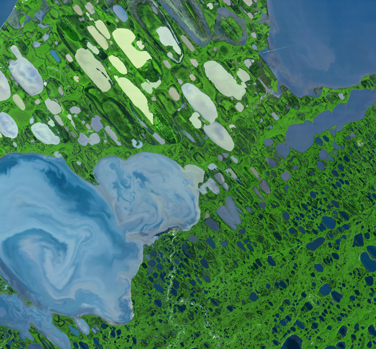
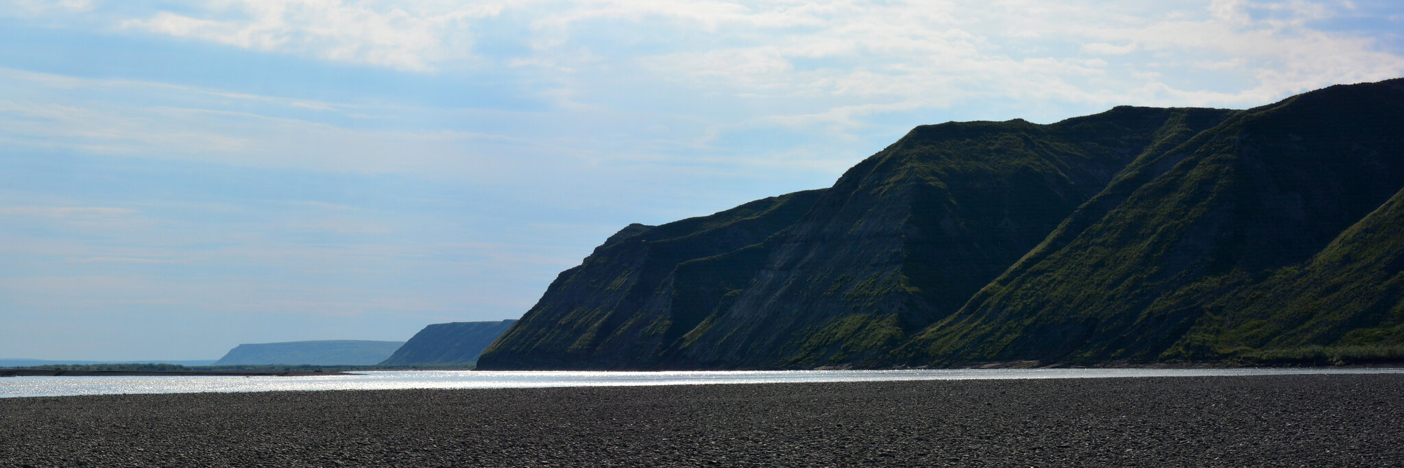
For the NPR-A, a key element of the new Integrated Activity Plan is the elimination of the Obama-era “special area” designation for Teshekpuk Lake and adjacent wetlands. The lake, at the northeastern corner of the reserve, is the biggest on the North Slope and a major feature in the Arctic Alaska environment. It is important habitat for migrating birds, and the wetlands around it are home to the Teshekpuk Caribou Herd, which numbered more than 56,000 animals as of 2017. That herd is important for subsistence hunting by residents of five villages and is unusual in that it tends to stay on the North Slope year-round, instead of migrating south.
[Even after decades, caribou still aren’t fully used to oil development, scientists say]
But the lake and its wetlands lie in an area that might hold a lot of oil. The lake is near areas already explored and under development, and there are indications that the vast Nanushuk formation, the source of important new North Slope oil discoveries, extends to the lake.
“New data suggests significant recoverable oil estimates in the Teshekpuk Lake Special Area, one of the most highly prospective regions in the Reserve,” Lesli Ellis-Wouters, a BLM spokeswoman in Alaska, said in an email.
That new information about Nanushuk oil potential was cited by Interior officials when the BLM last November released its draft EIS for the integrated activity plan rewrite.
The preferred alternative in the final EIS does impose some Teshekpuk Lake-area protections, such as a ban on surface occupancy, which were recommended by during the planning process, Ellis-Wouters said.
“The input we received from stakeholders was critical to helping us designate areas for no surface occupancy, as well as deferring potential activity in important migration corridors. The preferred alternative contains more stringent required operating procedures and stipulations for the Teshekpuk Lake area, for example, than in other areas of the NPR-A as a direct result of input we received on the draft EIS,” she said.
The new plan also eliminates the Colville River special area designation, intended to protect an ecologically important Arctic river and the birds that use it. The new plan extends Colville-area raptor protections to the entirety of the reserve, so “no unique management prescriptions apply in the area, and thus special area designation is not warranted,” the final EIS said.
The Obama administration’s Integrated Activity Plan established five special areas to be off-limits to oil development — incorporating expansions of previous protections for Teshekpuk Lake and the Colville River. The Trump administration plan reduces those designations to three, all of them in areas with little oil potential.
The new Integrated Activity Plan will go into effect after the BLM issues its record of decision. That decision will come at least 30 days after the final EIS is published in the Federal Register, the agency said. Once that plan is in effect, future lease sales will be governed by it, Ellis-Wouters said.
Environmentalists blasted the new plan and the process that led to it.
“Though long expected, the final environmental impact statement is another sad and harmful development in this administration’s shameful race to destroy public lands by auctioning off wild, irreplaceable ecosystems for industrial development,” David Krause, Alaska assistant director for The Wilderness Society, said in a statement.
The plan shows “a disregard for science and the climate reality the planet faces,” Krause said in the statement. “And now, while a global oversupply of oil is holding down prices and forcing companies to reduce production, this administration wants to sell our public lands at bargain-basement prices for oil production the nation doesn’t need and shouldn’t burn. It is unconscionable.”
[Suddenly, new investment in Arctic Alaska oil looks very unlikely]
“Nationally and globally, inequities in the impacts of the fossil fuel industry on marginalized and rural people have become undeniably clear in recent months, and we condemn the administration’s dismissal of the health and perspective of Alaska Native people most impacted by this plan. We will continue to protect the places we love and depend on,” said a joint statement issued by 10 environmental and Alaska Native organizations.
Environmentalists are weighing options for legal challenges, both to the new IAP itself and to any lease sales that might be offered under it, said Suzanne Bostrom, an attorney with the environmental law firm Trustees for Alaska.
Opening Teshekpuk Lake is particularly troublesome, she said. “This has been protected for decades because of its importance to birds, caribou, subsistence,” she said. “So them sweeping these protections off the table is a significant concern.”
But oil development backers, including Alaska’s all-Republican Congressional delegation, hailed the new plan and the demise of the Obama-era protections.
“As Alaskans work toward economic recovery, having a robust plan to unlock the potential of one of the most promising areas on the North Slope is a powerful tool,” Sen. Lisa Murkowski said in a joint statement released with Sen. Dan Sullivan and Rep. Don Young.
“The NPR-A contains vast resources that will be vital as we get our economy going again and continue expanding the role of the U.S. as an energy superpower,” Sullivan said in the statement.
The administration of Gov. Mike Dunleavy also applauded the move.
“As America’s only Arctic State, it was refreshing that the Federal Administration considered Alaska’s science and our local understanding of the subtle environmental nuance that is Alaska’s North Slope when making this critical decision in its EIS for the conservation of the environment and the security of this Nation,” Doug Vincent-Lang, commissioner of the Alaska Department of Fish and Game, said in a statement released by the Republican governor, adding that the state believes the reserve’s oil and gas resources can be developed in an environmentally safe way.
The National Petroleum Reserve was established in 1923 as the Naval Petroleum Reserve No. 4, one of a handful of federal land units intended to provide petroleum to the nation’s military forces. Under a 1976 law, it was transferred to Interior and reassigned as a land unit to be managed for multiple uses, including environmental protection.
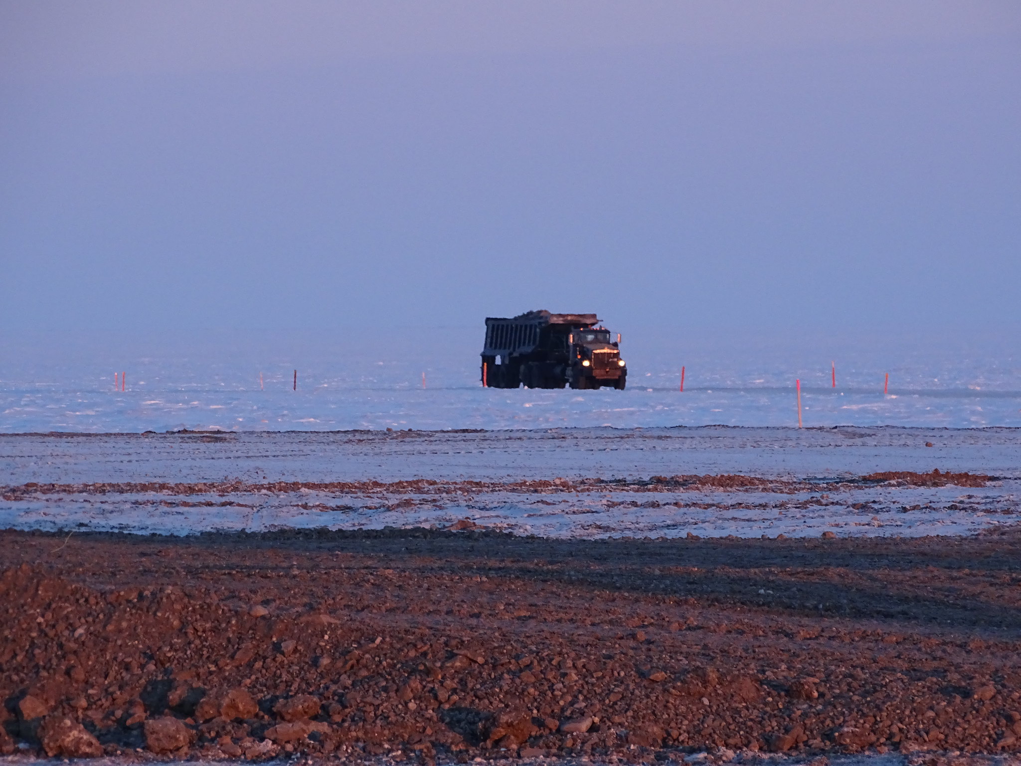
For decades, there was little oil activity in the reserve. The vast majority of North Slope oil development has occurred to the west, on state land around Prudhoe Bay. But now the NPR-A, at least on its northeastern edge, has emerged as a hotspot for new development.
Exploration in the northeastern part of the reserve since the early 2000s has produced several discoveries, and the first oil production within the reserve’s boundaries began in 2015.
Thanks to the existing development in the NPR-A — notably the huge Willow discovery being pursued by ConocoPhillips Alaska Inc. — there will be some future oil production in the reserve. But opening up the new areas is expected to vastly increase ultimate production, said the final environmental impact statement for the new integrated activity plan.
Future expected NPR-A development ranges from low-development scenario, with daily production hitting a maximum of 120,000 barrels per day, largely from Willow, to a much more expansive 500,000 barrels-per-day peak in a high-development scenario, the document said. Under the high-development scenario, there would be three centralized processing facilities, 20 satellite pads, 250 miles of roads, 240 miles of pipelines and other new facilities in the petroleum reserve.