🇳🇴 Tromsø Uncovered: KSAT – Monitoring the Rain Forest from Space

This is the second article in a new series by Pro Tromsø and the Tromsø Chamber of Commerce, highlighting northern Norway’s unique innovative capabilities through a number of interviews with cutting-edge start-ups and the people behind them, profiles of leading companies, and insight into the entrepreneurial work being undertaken in the capital of the Arctic.
The second article profiles KSAT and Tromsø’s role in satellite-based earth observation and features CEO Rolf Skatteboe as he discusses their involvement in a project to stop deforestation of the Amazon.
Tromsø is the satellite-based earth observation capital of Norway, with 500 employees and an annual turnover of NOK 2.5 billion within space observation and related activities. Efforts are now being made to establish a National Earth Observation Centre in the Arctic capital.
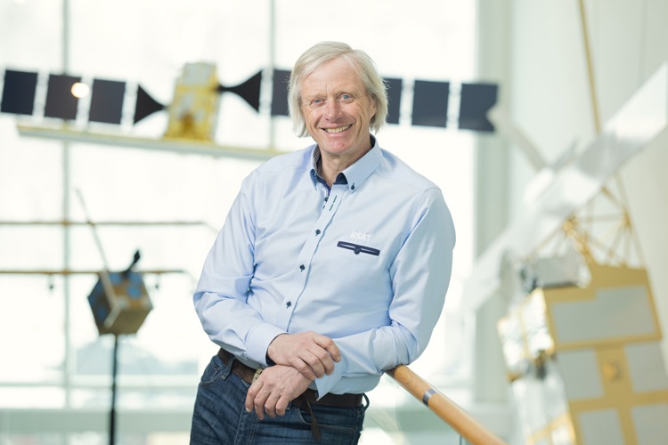
“The space environment in Tromsø is already well developed, with actors such as UiT, Norse and various upstream industries and users such as the Norwegian Meteorological Institute and the Norwegian Polar Institute,” says the CEO of KSAT, Rolf Skatteboe.
“A decision has already been made to establish the centre, but there is still some uncertainty about financing and certain details. However, the plan is to have an innovation lab in collaboration with the European Space Center ready by the end of 2023 and the centre operational during 2024,” he says.
The idea behind the concept is to develop new and creative services based on satellite observations. In Tromsø, we have considerable specialist expertise and an exciting innovation environment, so the centre would certainly benefit from being located here. It will also provide a great opportunity to attract even more expertise,” says Skatteboe, who also mentions the plans for launches from Andøya.
“The first launch is scheduled for late 2023. This will constitute a strong specialist environment that is unique in the Norwegian context, which builds on expertise as well as geographical suitability.”
Monitoring the rainforest from space
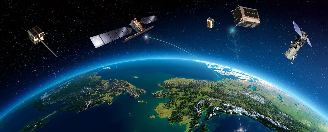
As the world’s leading commercial satellite centre, KSAT operates earth observation of the entire world in Tromsø. KSAT is now involved in a project to stop deforestation of the Amazon.
The company’s agreements with satellite owners and 27 ground stations with more than 260 antennas spread all over the world combine to make KSAT the world’s leading commercial earth observation centre.
“KSAT does not have any satellites of its own, but we are experts when it comes to receiving and processing data from satellites in orbit,” says Skatteboe.
“We communicate with satellites about 1.3 million times per year. This enables us to always be able to supply our customers, public authorities and private companies alike, with images of the earth. For instance, when you use Google Earth, this is where the images come from,” he explains.
The same applies to weather forecasts. KSAT receives data from European and American weather forecasting satellites, and the data are used for weather forecasting services and hazard warnings. For instance, when Florida is considering evacuations because of a hurricane, the data comes from KSAT.
Monitoring of shipping traffic and climate and environmental monitoring, such as detecting oil spills, are also areas of application for KSAT’s data.
“Our systems can contribute to uncovering major societal issues such as illegal fishing,” says Skatteboe.
“There is a constantly increasing need for knowledge about what is happening on earth. This relates to changes in the macro perspective and more local movements. Satellites can provide us with information about places that would otherwise be virtually impossible to know anything about. KSAT has specialised in collecting such information in an efficient and secure manner. This is how we contribute to our customers always being able to make the right decisions,” says Skatteboe, who has led the organisation since its inception in 2002.
“We’re not only talking about images, but all kinds of data that may be collected by satellites, which are often equipped with many sensors that measure different parameters and take pictures of the Earth.”
It’s no coincidence that KSAT is based in Tromsø and Northern Norway. A high proportion of the satellites are in polar orbit, which means they fly over the earth from pole to pole. As the satellites fly, the Earth rotates, which means that each satellite covers a much larger surface than if they were orbiting above the equator.
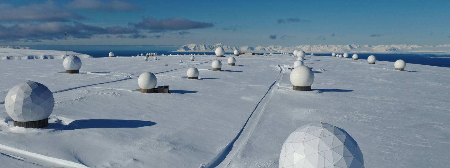
This also enables KSAT to collect data from all the satellites with antennas placed near the poles. “The further north or south you go, the closer you are to the point where all the satellites pass in orbit,” explains Skatteboe.
“In Svalbard, where we have one of our largest ground stations, we can receive signals from all satellites in polar orbit from one station, which is a major advantage,” he says. Each satellite uses 100 minutes to orbit the Earth, and they pass over Svalbard 14 times a day. The satellites are above Svalbard for about seven minutes each time.
“There’s a lot of data, that’s for sure, but we are equipped to handle that,” says Skatteboe, smiling.
Among the innovations KSAT has been involved in is continuous monitoring of the world’s tropical forests.
“It was Norway’s International Climate and Forest Initiative (NICFI) and the Ministry of Climate and Environment that had the idea,” says Skatteboe.

“Satellite images can be crucial for monitoring deforestation and discovering illegal activities, but they are expensive. What if we fund continuous satellite monitoring and publish the images free of charge so everyone can use the information?” This has now become reality. Everyone can now see satellite images of the world’s tropical forests at any time. The image mosaic, which has a resolution of 5-20 m, is updated twice a month. As it’s possible to see images back to 2015, you can see the historical development.
“This is something that Norway delivers free of charge to the entire world. Over time, the service has gained around 16,000 international users,” says Skatteboe.
“In my opinion, this is one of the smartest things Norway has ever done. It’s an extremely effective way of ensuring that countries that cannot afford this type of monitoring get access to data,” he says.
He now hopes to establish a similar system to monitor illegal fishing.
“It’s a major problem that many of the countries where illegal fishing takes place cannot afford monitoring and, as such, cannot deal with the problems.”
A monitoring system with free access would give these countries the opportunity to enforce the law and would probably also have a preventive effect, says Skatteboe. He describes a momentous development with more and more satellites in orbit.
“Increasing investment in small satellites combined with much lower launch costs means that we will experience a significant increase in the number in the years to come.”
Around 12,000 satellites have been launched between 1957, when the first satellites were launched, and the present day. Of these, 7,000 are still orbiting. However, 1,700 satellites were launched last year alone. “That sums up the development. It’s also worth noting that more than 10,000 satellites will be launched during the next decade.”
We want to know if there is a use for all these satellites.
The answer is clear. “More satellites increase our opportunity for precise monitoring and give us far more data. This gives us a better basis for decisionmaking and much more information about what is happening to the Earth and that’s important,” says Skatteboe.
“Many people are afraid that this will create space junk, but there is no need to worry. Modern satellites are equipped to descend at the end of their lifespan, so they re-enter the atmosphere and burn up,” Skatteboe concludes.
This article was originally produced as sponsored content by Pro Tromsø in their appendix from the Norwegian Business Journal, produced in cooperation with the Tromsø Chamber of Commerce.
This article was originally published in Norwegian and has been translated by Pro Tromsø.
To join the Arctic Business Journal network as a sponsored content partner, contact us at [email protected].